In 1520, during Ferdinand Magellan’s expedition around the world, the name “Patagonia” was first used when Magellan referred to the Tehuelches, a native people, according to the chronicler Antonio Pigafetta. The denomination arose after a mutiny in the expedition, where Magellan observed the indigenous people’s large feet. Although the exact origin of the term is uncertain, it is believed to have been inspired by the chivalric novel “Primaleón,” published in 1512, which described a barbaric giant called “Patagón.” This reading influenced Magellan and led to the adoption of the name for the Tehuelches and subsequently for the region itself.

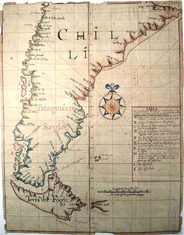
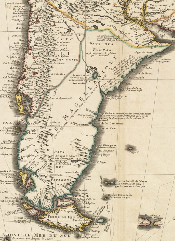
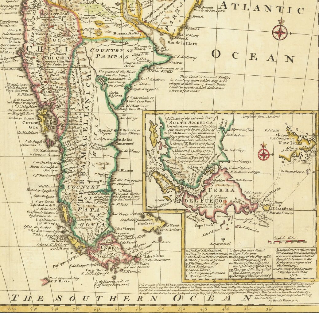
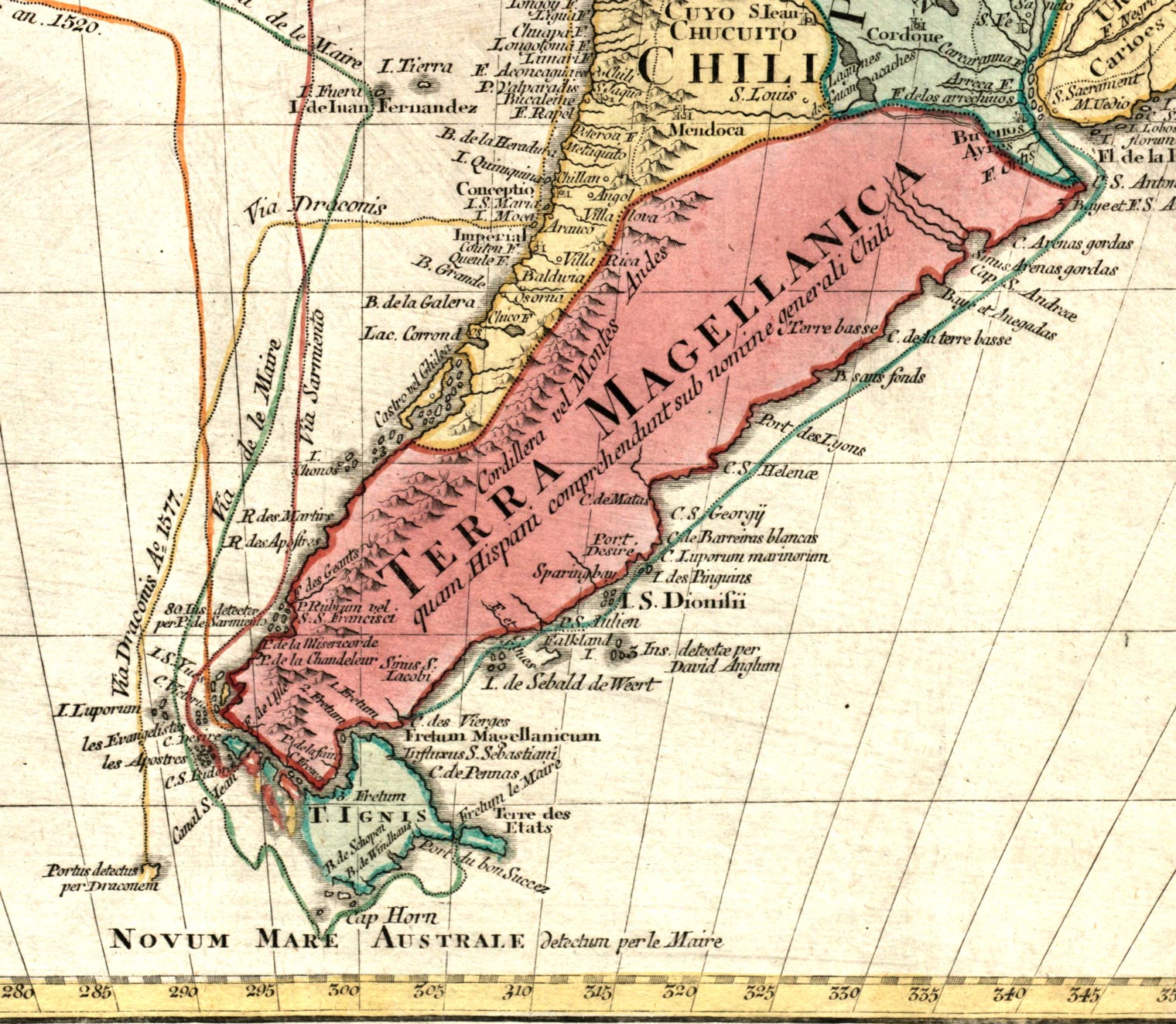
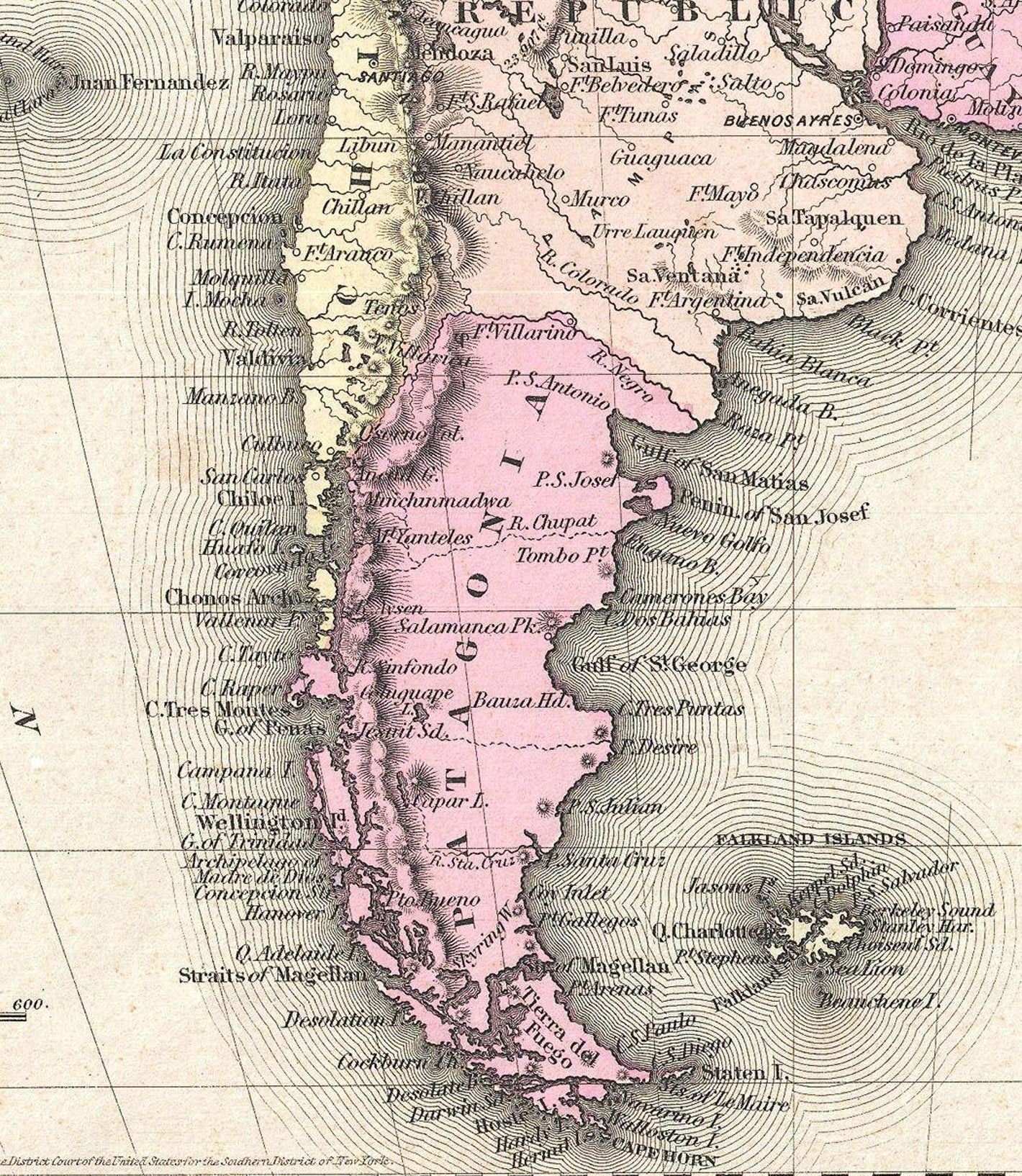
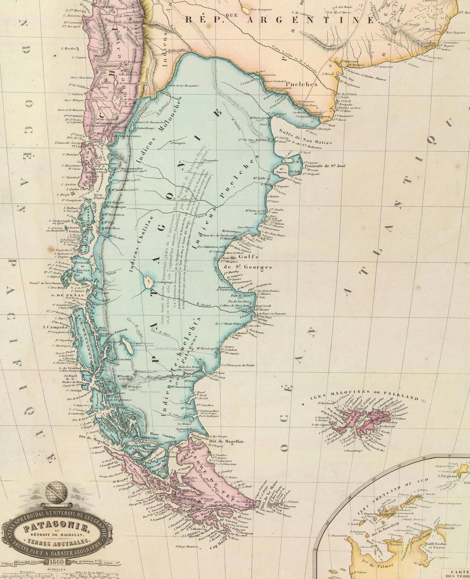
Boundaries and Location of Patagonia
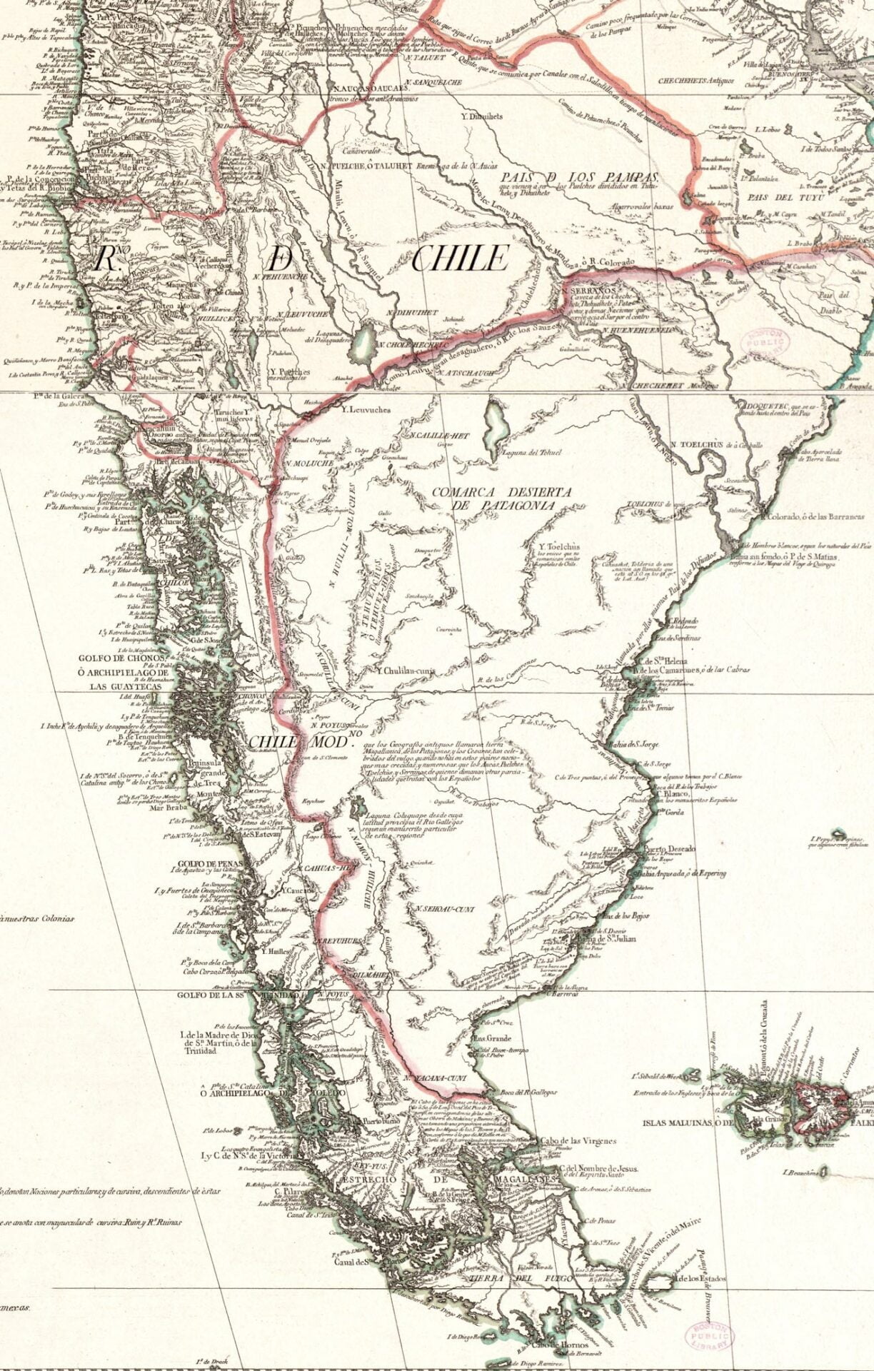
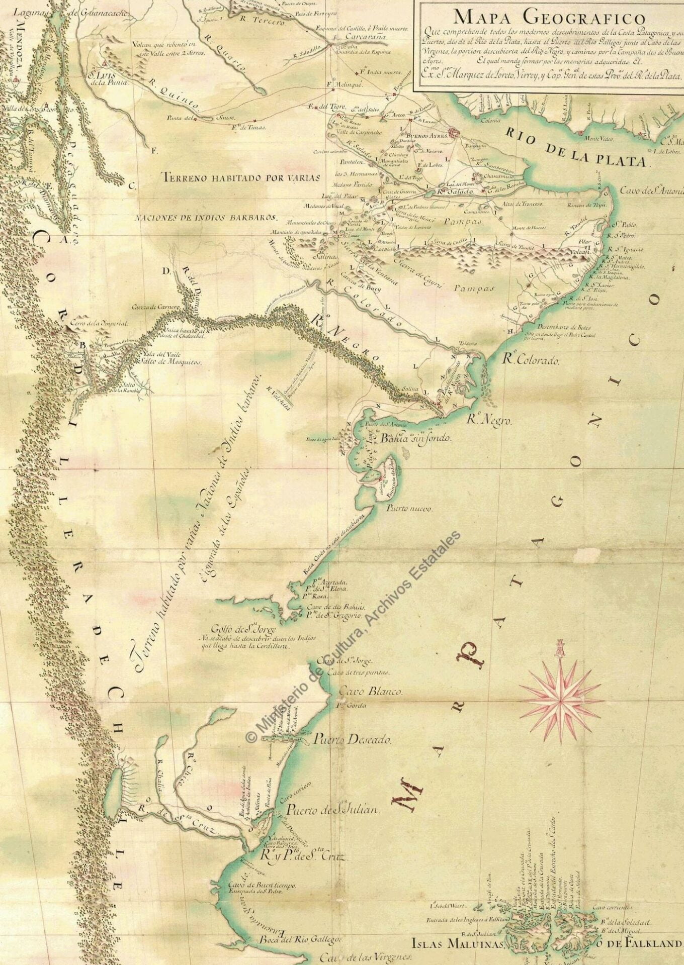
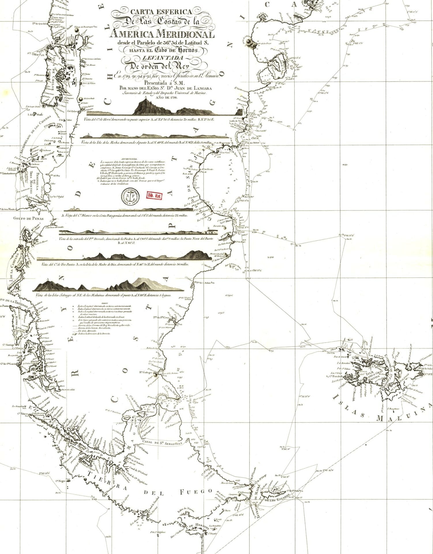
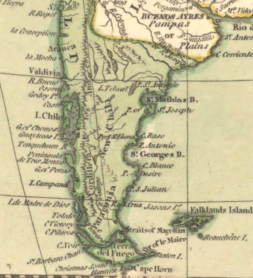
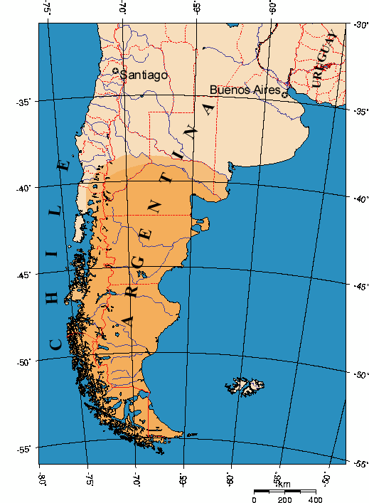
In the present day, the northern boundary of Argentine Patagonia, from east to west, is considered to be the line formed by the mouth of the Colorado River in the Argentine Sea, continuing from there to the confluence of the Grande and Barrancas rivers (border between the provinces of Neuquén and Mendoza). The region extends eastward to the border with the Republic of Chile. On the other hand, the northern boundary of Chilean Patagonia is not entirely defined. The boundary, from west to east, begins in the Reloncaví Sound, following the estuary of the same name, the Petrohué River, Lake Todos los Santos, and the Peulla River, until it reaches Cerro Tronador at the border with Argentina.
Some also indicate and extend its location northward to the 39° south latitude, around Villarrica. However, currently, the territories further north are also considered, naming it Norpatagonia, from the Reloncaví Sound to the Araucanía Region, considering the Huincul Fault. On the southern end, the boundary of Chilean Patagonia used to be fixed at the Strait of Magellan, but it is now usually extended to Cape Horn.