
Historical maps of Patagonia offer a unique window to explore the evolution of this region from the 17th century to the present day. Through these maps, we can appreciate not only the advances in cartography but also the changes in the perception and geographical knowledge of Patagonia.
17th Century Maps: The First Glimpses
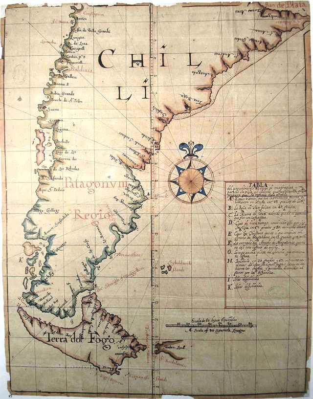
In the 17th century, the first European explorers began mapping Patagonia. These maps, although rudimentary, are a testament to the initial efforts to understand this remote region. One of the earliest known maps is from 1671, reflecting the limited information available at that time.
Curious fact: Early maps described Patagonia as a land of giants, inspired by the accounts of explorers who claimed to have seen inhabitants of great stature.
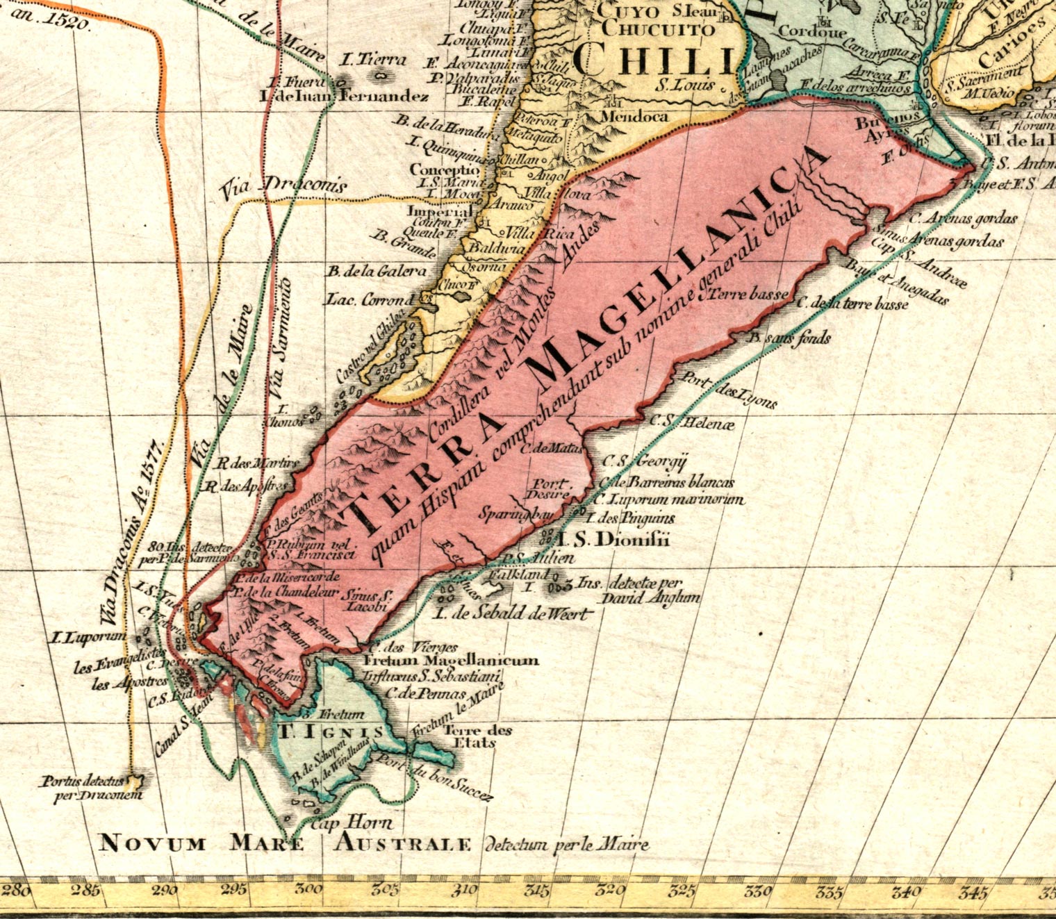
18th Century Maps: Increased Precision
By the 18th century, more detailed expeditions allowed for a better understanding of Patagonia’s geographical features. The historical maps of Patagonia from 1744 reflect a higher degree of accuracy and detail, showing clearer topography and the first European settlements.
Curious fact: French naturalist Louis-Antoine de Bougainville, during his explorations, significantly improved the accuracy of Patagonia’s maps with his detailed observations.
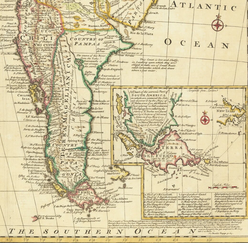
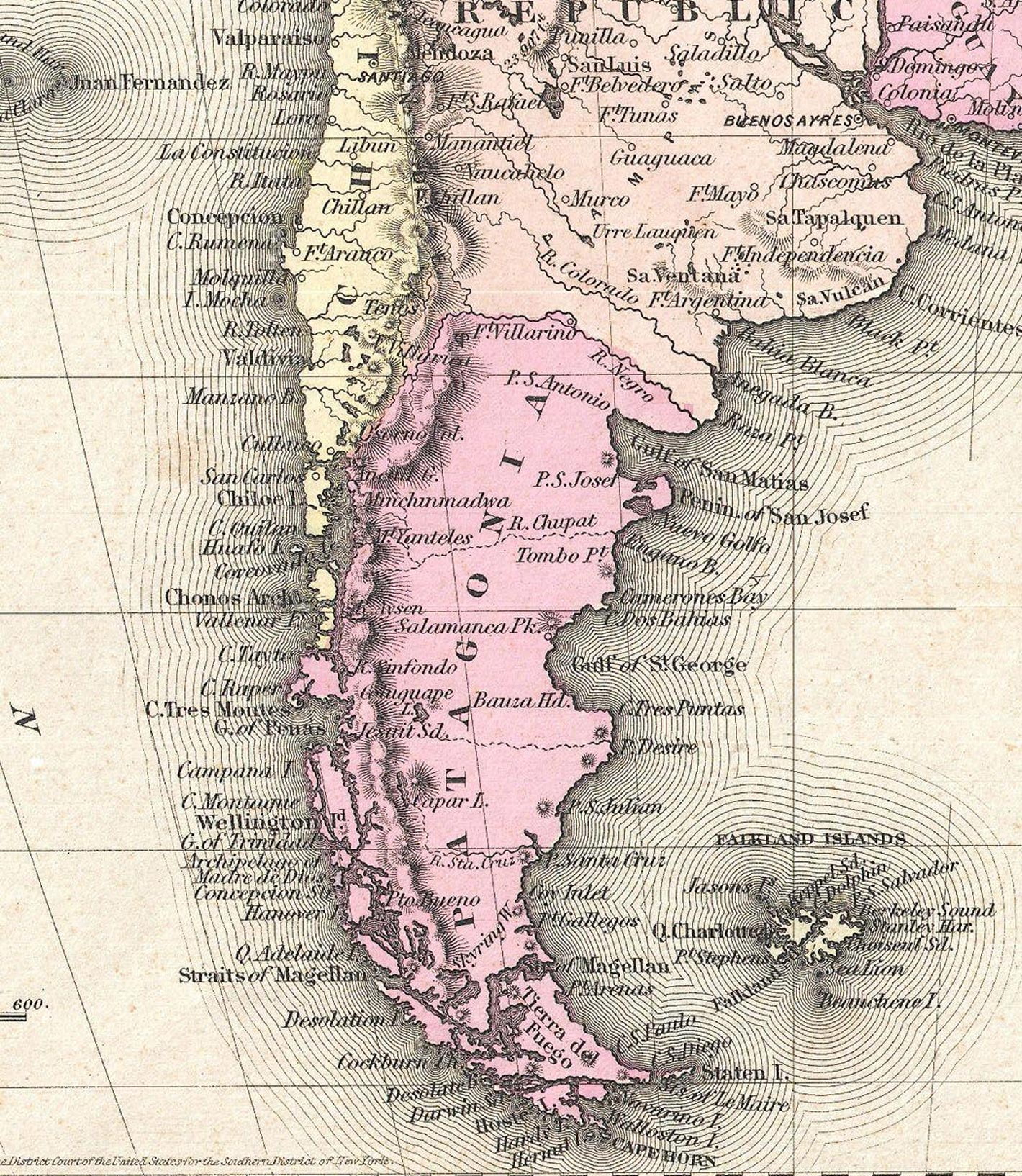
19th Century Maps: Exploration and Consolidation
The 19th century was a crucial period for Patagonia’s cartography. By 1786, previous knowledge had been consolidated, and new explorations added significant details. The maps from this period include additional exploration routes and notes on flora and fauna, showing a more accurate representation of the region.
Curious fact: Robert FitzRoy, the English explorer who sailed with Charles Darwin on the HMS Beagle, made important cartographic contributions to Patagonia in the 1830s.
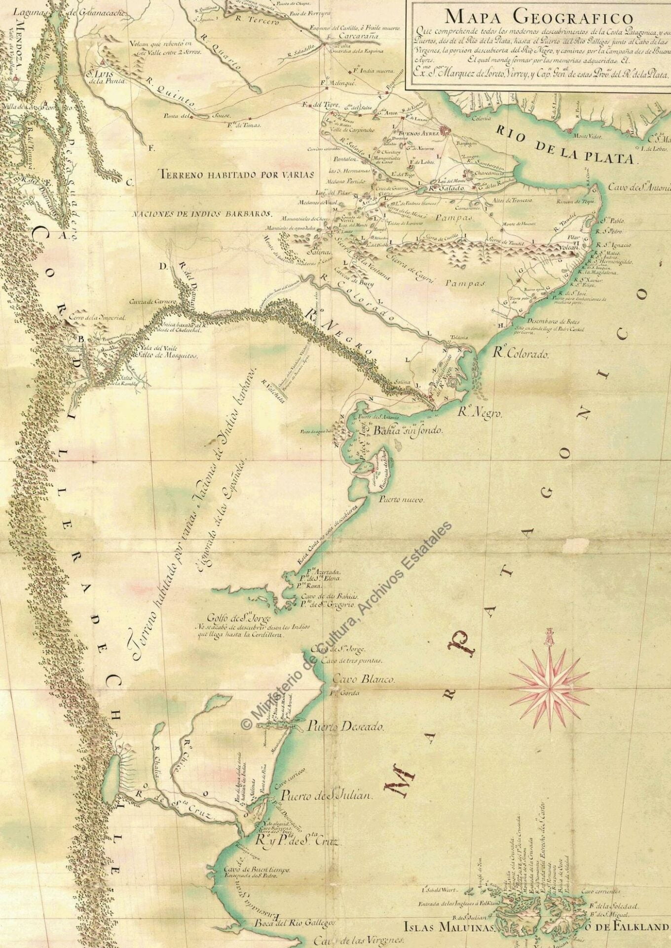
Maps of Patagonia and European Colonization
The massive arrival of European settlers brought significant changes to Patagonia’s cartography. The historical map of Patagonia from 1855 shows not only the topography but also trade routes and conflict areas. This map is crucial for understanding the social and economic changes of the time.
Curious fact: During this period, many of the current toponyms, such as Río Gallegos and Punta Arenas, were established.
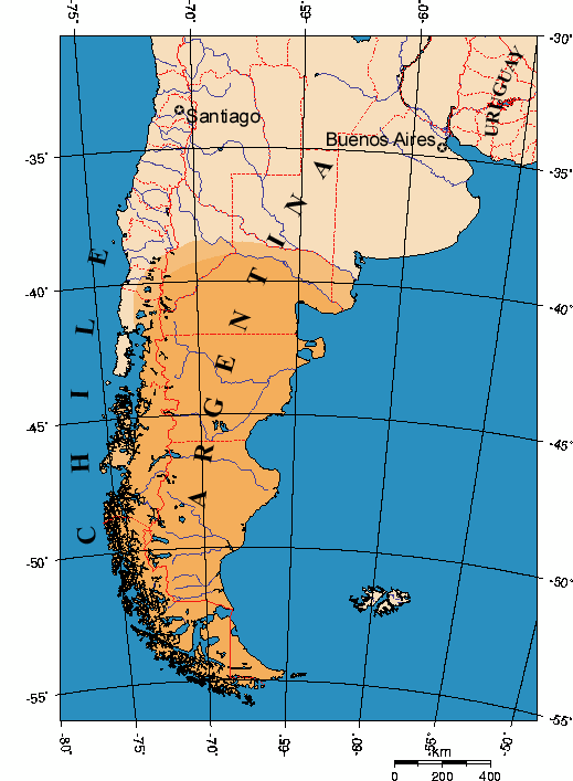
Modern Cartography of Patagonia
Today, the maps of Patagonia are extremely detailed thanks to advanced technology and satellite imagery. These modern maps allow for a direct contrast with their historical counterparts, showing how much the region has changed over the centuries. Modern cartography is essential for environmental studies, land planning, and appreciating Patagonia’s rich history.
Curious fact: Modern satellite imagery allows for precise identification of ecosystems and planning of tourist routes and protected areas, something unimaginable in the early days of cartography.
For more information on the historical maps of Patagonia and their evolution, visit this link to a relevant source. Also, explore our history section to discover more about the region’s rich history.
Frequently Asked Questions
1. What do historical maps of Patagonia reveal about how our understanding of the region has changed over time?
Historical maps of Patagonia showcase the evolution of geographical knowledge from the 17th century to present day, revealing not only advances in cartographic techniques but also how European perceptions and understanding of the region transformed. These maps document the progression from rudimentary, speculative representations to increasingly accurate and detailed depictions as exploration intensified.
2. Why were 17th century maps of Patagonia so inaccurate and what did they claim about the region?
17th century maps of Patagonia were rudimentary because explorers had limited access to the remote region and incomplete information about its geography. Early mapmakers famously described Patagonia as a land of giants, inspired by explorer accounts claiming to have encountered inhabitants of exceptional stature, demonstrating how myth and speculation influenced early cartography.
3. How did 18th century maps improve upon earlier representations of Patagonia?
By the 18th century, more detailed expeditions enabled cartographers to create maps with significantly greater accuracy and detail, as exemplified by maps from 1744 that showed clearer topography and the first European settlements. Notable explorers like French naturalist Louis-Antoine de Bougainville contributed substantially to this improvement through their detailed observations and systematic documentation.
4. Which historical explorers made the most significant contributions to mapping Patagonia accurately?
French naturalist Louis-Antoine de Bougainville was among the most significant contributors to accurate Patagonian cartography through his detailed observations during his explorations. His work, documented in 18th century maps, represented a major leap forward in the precision and reliability of the region’s geographical representation.
5. What is the earliest known historical map of Patagonia and when was it created?
One of the earliest known maps of Patagonia dates to 1671, representing the initial European efforts to understand and document this remote region. Although rudimentary by modern standards, this map is a testament to the challenges early explorers faced in mapping unfamiliar territories with limited information.
6. What role did the 19th century play in the development of Patagonian cartography?
The 19th century was a crucial period for Patagonia’s cartography, building upon the foundation established in previous centuries with further exploration and consolidation of geographical knowledge. This era marked the transition toward the comprehensive and accurate maps that would define modern understanding of the region.